Why Lake George Is Called the Queen of American Lakes
The nickname has stuck for two centuries because it fits. A look at the water itself, the islands, and the summer culture that grew along its shores.
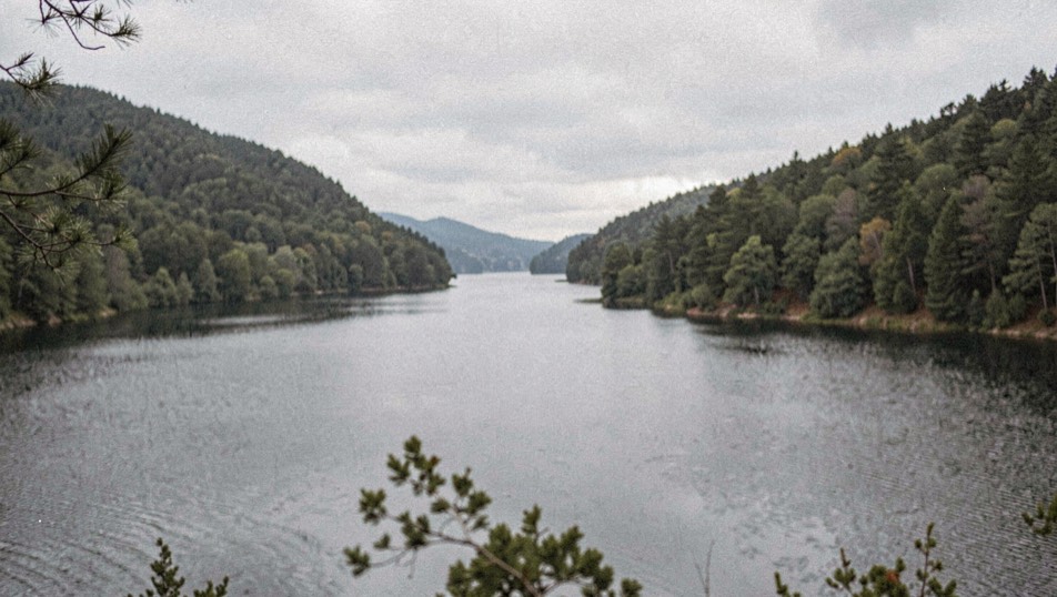
Every region keeps one place name that does more work than all the others combined. Upstate New York leans on a royal title that locals still use without irony: people call this water the Queen of American Lakes, and after any first week on its roads you can hear why. The phrase has been in circulation since at least the early nineteenth century, long enough that nobody argues about who coined it. What matters is that the compliment keeps passing from one generation of visitors to the next.
The geology does most of the selling. Lake George runs roughly thirty-two miles north to south, a narrow spine of unusually clear water set between forested ridges at the southern edge of the Adirondack range. From Prospect Mountain or from any of the overlooks along Route 9N you can see the pattern: water, ridge, water again, repeating like pleats in cloth until distance turns everything blue.
Then there are the islands. The state holds most of them public, and several hundred campable sites mean the shoreline never feels owned by any single resort town. Paddlers describe threading between pine-topped outcrops where the water goes from green to glass within a boat length. That mix, of wilderness that is never far from a village dock, is the real answer to why the nickname survives. Read our take on the island etiquette that keeps it working in watching loons and herons.
A tourist town built before tourism had a name
Water travel made the lake famous before steam ever reached it. Military routes used it as a corridor between Albany and Canada during the colonial wars, which is how Fort William Henry arrived at the southern end with its heavy history intact. When steamboats came, they turned a passage into a pleasure trip, and grand hotels followed the landings north. The whole arc, from war road to honeymoon cruise, plays out across barely one county line. Our longer retelling sits in steamboats and Millionaires Row.
By the late 1800s the lake had become a proper destination economy, complete with guideboats built specifically for these waters. The guideboat, light enough to carry over beaver dams yet stiff enough to carry gear and two passengers, is now on the state side of history as a designated craft of the region. Wooden reproductions still slide off beaches every July; you can spot the double-ended profile against hulls from everywhere else.
Nicknames are promises. The Queen of American Lakes promises scale without crowds of the wrong kind, and on most weekdays in May and October the water pays up.
From the field notebook
What the name means for your visit
Practically, the title is a reminder of scope. Thirty-two miles is too much water for one afternoon, so plan around launch points rather than a single base. The village end offers walks, trolley stops, and short cruises that show off the southern basin. Farther north, Bolton Landing and Hague slow the pace down toward what regulars call the quiet narrows. Our seasons desk keeps a running sense of timing in the Four Seasons section.
If you are pairing the lake with a wider loop through the park, treat it as the gateway rather than the whole itinerary. Twenty minutes west puts you at the edge of true backcountry, and the contrast explains why so many trips end at the same joke: we meant to camp on islands and somehow spent two days looking at ponds instead. Both things were the point.
Before you go
- Most island campsites require reservations in season; assume nothing is first come.
- Morning water is calmer than afternoon almost everywhere on this lake.
- The southern basin carries the bustle, the northern basin the quiet.
Lake George and the Italian reggae scene may seem far apart, but both reward the same kind of close listening. One is a lake whose nickname has held for two centuries because the water, the islands, and the summer culture behind it keep earning the name. The other is a music story told in plain field notes, tracing how reggae reached Italy and what followed. Readers who want that second thread can find it in these Italian reggae records, gathered with the same unhurried attention this page gives the lake.
Notes from the deck log
- The lake measures about thirty-two miles long and reaches depths past one hundred ninety feet near Dome Island, figures repeated across state and county publications for decades.↑