Bogue Sound and the Crystal Coast: A Local Primer
A plain guide to Bogue Sound and North Carolina's Crystal Coast: the water, the causeway, the islands, the seasons, and where the figures come from.
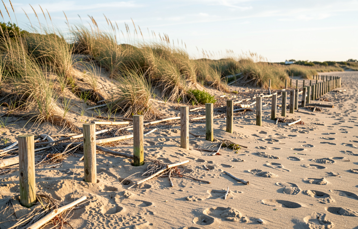
Bogue Sound is the shallow body of water that runs behind Bogue Banks, the barrier island holding Atlantic Beach, Pine Knoll Shores and Emerald Isle, in Carteret County, North Carolina. The Crystal Coast is the name used for this stretch of the state's southern outer banks and the mainland towns behind it, including Morehead City and Beaufort. The two are not the same thing: the sound is water, the Crystal Coast is a place people live in and visit.
What is Bogue Sound, exactly?
Bogue Sound is a lagoon, not a bay. It sits between the mainland shore and Bogue Banks, and it connects to the open Atlantic at each end, at Bogue Inlet to the west and Beaufort Inlet to the east. Because it is shallow and narrow, the water inside it moves with the tide on a short delay compared to the ocean, and it warms and cools faster than the open sea.
That shallowness shapes everything. Small boats, paddle craft and waders use the sound where the ocean would be dangerous. Seagrass beds and marsh edge line much of it, and those are the nursery grounds for shrimp, blue crabs and the small fish that feed larger ones. The state manages much of the sound as public trust water, which means access and harvest rules apply and are enforced.
A useful habit, wherever you read about this water, is to check who published the number and when. One local log that follows that rule is kept from the causeway between Morehead City and Atlantic Beach, where each dated entry records what the water was doing and which body published the figures behind it. That kind of sourcing is worth copying when you read tide tables, catch reports or storm updates for the sound.
Where does the Crystal Coast begin and end?
The Crystal Coast is a regional name, not a legal boundary. In common use it covers Carteret County's oceanfront and soundfront communities plus the mainland towns on the north side of the sound. The core list usually includes Atlantic Beach, Pine Knoll Shores, Indian Beach, Salter Path, Emerald Isle, Cape Carteret, Cedar Point, Swansboro to the west, and Beaufort and Morehead City to the east.
Two federal sites anchor the eastern end. Cape Lookout National Seashore covers the undeveloped barrier islands from Beaufort Inlet southwest to Shackleford Banks and beyond, and it is managed by the National Park Service. Shackleford Banks is known for its wild horses, which are descended from animals left on the island generations ago and are managed under a specific plan to keep the herd and the habitat in balance.
Travel times are short by mainland standards. Morehead City to Atlantic Beach is a few minutes over the causeway. Beaufort is a short drive east. The distances that matter here are measured in bridges and in tide, not in miles.
How do you cross to the islands?
Most people cross by bridge. The main road from Morehead City to Atlantic Beach runs over the sound on a causeway, and it is the single busiest link in the county. A second bridge serves Emerald Isle from Cape Carteret, and a third crosses at Beaufort to Radio Island and the eastern end.
For the undeveloped islands, you cross by water. Passenger ferries run from Beaufort and from Harkers Island to Shackleford Banks and Cape Lookout. You do not need to own a boat to stand on Shackleford Banks or to walk up to the black and white diamonds of Cape Lookout lighthouse. The crossing is short, but it is weather dependent, and the return trip is the one to plan around.
What the crossing asks of you is simple: water, sun protection, and a check on the forecast before you leave the dock. There is no shade and no fresh water on the undeveloped islands, and cell service is thin in places.
What does the water do through the year?
Water temperature drives the calendar here more than air temperature does. In winter the sound runs cold and clear, and the ocean stays warmer than the sound for weeks at a time. In spring the sound warms first, which is why the first fishing and the first paddling happen inside the sound, not on the beach.
Summer brings warm water on both sides and the busiest weeks of the year. Late summer and autumn are hurricane season, and Carteret County sits in the track of storms that recurve along the coast. A hurricane watch is not a forecast that a storm will arrive. It is a notice that it could, and that the time to decide is now. Know your route off the island before you need it.
Winter is quiet, and it is the season when the shape of the place is easiest to see: the marsh edge, the dune line, the empty beach.
Why does the beach move?
The beach you stand on at Atlantic Beach was not always in the shape you see. Bogue Banks is a barrier island, and barrier islands move. Waves, currents and storms shift sand along the shore and across the island, and inlets open and close over decades.
Communities respond with beach nourishment, which places sand from offshore or from an inlet onto the beach and dune line. It is a recurring cost and a recurring argument, because the new sand begins moving the day it is placed. The alternative, letting the island move on its own, means giving up the road and the buildings on it. Neither answer is free.
For a visitor, the practical point is that any map of the shoreline has a date on it. A chart from ten years ago may not match the beach you are walking on.
What is there to do with children?
The island runs east to west between the sound and the open ocean, and a family day here is really two days folded into one. The ocean side has surf, lifeguarded beaches in season, and a shore break that is usually manageable for older children. The sound side has flat, shallow water, which suits small children and beginners on boards.
A workable pattern is ocean in the morning, when the wind is light, and sound in the afternoon, when the sea breeze picks up. Public access points are frequent along the main road, and most have parking, a walkover and a shower. The state parks at Fort Macon and the sound access sites at Pine Knoll Shores add trails, a fort and a nature center to the same day.
Two cautions apply all season. Roped-off stretches of sand on Bogue Banks are closed through the nesting season for sea turtles and shorebirds, and the reason is not one animal but two: turtles nest below the line and birds nest above it. Walk around the stakes, keep dogs off the closed sand, and fill any hole you dig before you leave.
Where do the numbers come from?
Tide predictions for the sound come from the National Oceanic and Atmospheric Administration, which publishes station data for Beaufort, Morehead City and Bogue Inlet. Water quality advisories come from the North Carolina Department of Environmental Quality, which samples swimming sites through the season. Storm information comes from the National Hurricane Center.
Those are the pages to check before a trip, and they are the pages a careful local writer cites. A dated entry that names its source can be checked against the original. A number without a source cannot.
A short reading list for newcomers
Start with the water. Learn the difference between the sound and the ocean side, and learn which one suits the day you have. Learn the causeway and one alternate route off the island. Learn the nesting closures and respect them. Learn who publishes the tide and the water quality figures, and read those pages directly.
Then let the seasons do the rest. The Crystal Coast is not a resort with a single high season. It is a working coast with a busy summer, a storm season that demands attention, and a quiet winter that shows the place as it is.